
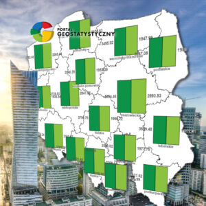
PGW Wody Polskie, Instytut Meteorologii i Gospodarki Wodnej – Państwowy Instytut Badawczy
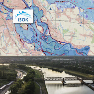
GISPartner successfully completed the contract with Polish Water Authority, which acted on its own behalf, and the Institute of Meteorology and Water Management - National Research Institute (IMGW), for the reconstruction and completion of the IT Country Protection System (ISOK).
In a short time, work was carried out to restore the system environment, supplying it with data, configuring and implementing a number of applications.
It is worth noting that the vast majority of the System is based on the standard products of GISPartner and GeoTechnologies based on the iMap Platform.
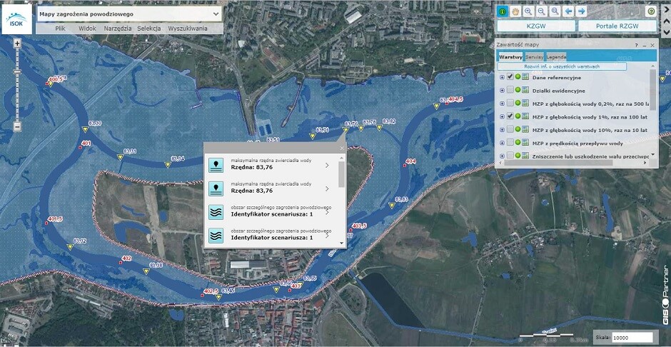
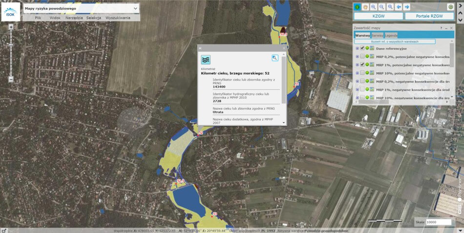
The key elements of the System are: the Hydroportal and the National ISOK Portal.
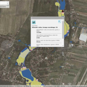
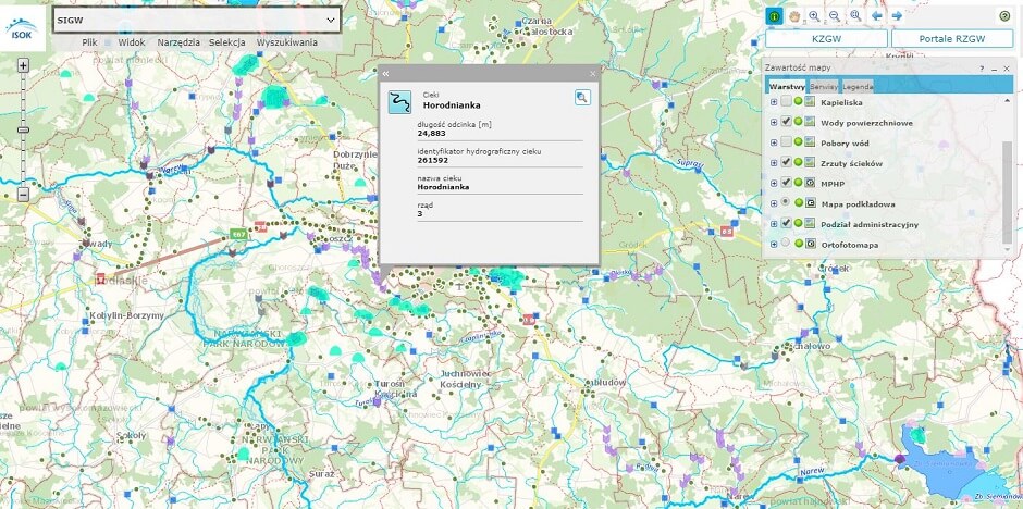
Hydroportal - a public portal covering the broadly understood subject of water management in Poland. It publishes map data sets, including:
- Preliminary flood risk assessment,
- Flood risk maps,
- Flood hazard maps,
- Flood risk management plans.
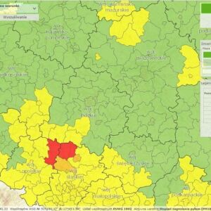
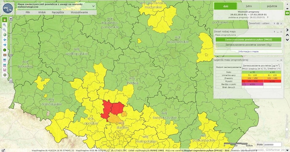
ISOK National Portal - a portal that allows you to view and analyze data published by the IMWM in the field of current meteorological and hydrological warnings and meteorological hazard maps.
In total, data is presented for 8 atmospheric hazards, such as: thermal hazards, high wind speeds, high snowfall, fog, black ice, hailstorm, rime, and intense precipitation.
The threats have been selected as posing the greatest threat to human health and life and economic activity, as well as to the natural environment.
In the prognostic maps of other threats, the analyzed threats were made dependent on the hydrological and meteorological conditions that cause them. Based on these data, the following maps were developed:
- air pollution map due to meteorological conditions,
- map of major industrial accidents due to meteorological conditions,
- a map of disturbances in power grids due to meteorological conditions,
- a map of threats to the life and health of the population due to meteorological conditions,
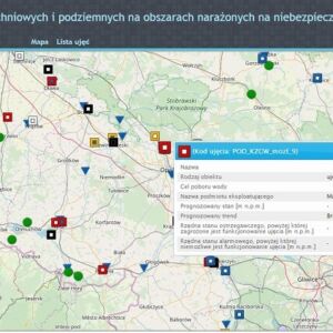
- map of surface and groundwater intakes in flood-prone areas.
The Alerts and Notifications Module is dedicated to citizens and crisis management services. I allows a quick subscription notifications for selected threats.
In addition to portals available to all users, applications have been created to facilitate the work of officials, such as:
Registration portal for Water Management Information System - an application that allows employees to keep records in accordance with the Water Law Act. It allows you to enter and read data on water management from an activated and supplied huge spatial and descriptive database.
Case Management Module - used to support the implementation of business processes in an organization by assigning tasks related to conducted cases to specific users and user groups. The module "guides" the user along the model path of a given business process, while enabling flexible response in situations unusual for the standard course of the process.
Electronic Support Portal - allows you to fill in and send applications to specific organizational units of Polish Water Authority. It uses tools such as Trusted Profile and Electronic Signature to authorize users.
The data distribution module allows authorized users to load, process and distribute ISOK spatial data sets and their own data, loaded from the external sources. The user has constant access to the most up-to-date system data.
The INSPIRE component resulting from the requirements of Directive 2007/2 / EC of the European Parliament and of the Council of Europe of 14 March 2007 establishing an Infrastructure for Spatial Information in the European Community (INSPIRE), enables, through network services, to: Search (metadata), Browse (maps), Collecting (data) interpellation and harmonized spatial data for many themes made available by the System. INSPIRE provides 19 such services.
In summary, the ISOK System enables effective monitoring of the risk of meteorological and hydrological hazards. In its intention, the system, through the support of Polish Water Authority and other authorities dealing with the subject of crisis management, ensures effective monitoring, notification of possible threats and protects the country against social, economic and environmental consequences of possible threats.
