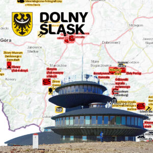
Karkonosze treasury of knowledge
The project concerned the delivery and implementation of the Polish-Czech Karkonosze Geoportal. The aim was to create a common and coherent geoinformation infrastructure in such a way that the Karkonosze Mountains would become a cross-border area treated as a whole, both in the process of planning and environmental management.
This geoportal is an international scientific portal that collects data on the current state of the environment and information on conducted or currently conducted research in a given area in a joint database of Poland and the Czech Republic. Thanks to such a knowledge and experience base, employees of parks in both countries, as well as people undertaking scientific research, will not only have easier access to obtaining many previously unavailable data, but also will not have to unnecessarily waste time on research that has already been conducted.
The users have access to the following modules:
- Scientific research module - available only to authorized users, enables registration of scientific research as well as ordering and sharing of source data for scientific and didactic purposes,
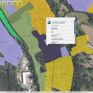
- Peatland ecosystems - containing information on peatland ecosystems in the Karkonosze National Park,
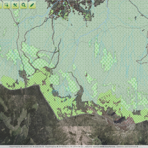
- Fauna - displays a layer presenting the occurrence (point) of selected animal species in a specific area and a layer with a Bird Atlas grid,
- Flora - presents the spatial distribution of flora species in the Karkonosze National Park,
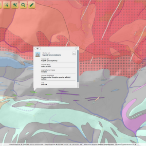
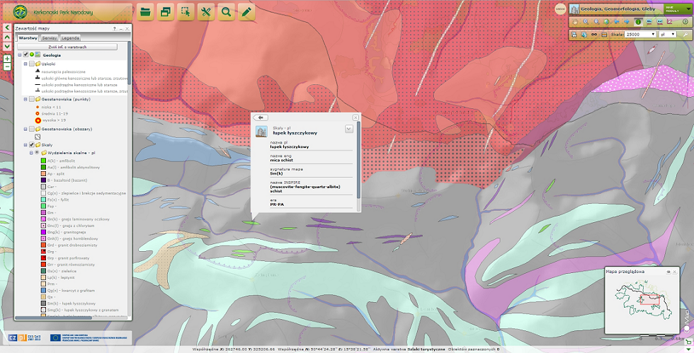
- Geology, Geomorphology, Soils - presenting geological data, geomorphological data and soil data from the Karkonosze National Park,
- Ecological corridors - containing information on the location of ecological corridors in the Czech part of the park,
- Forest Ecosystems - containing information on forest complexes in the Karkonosze National Park,
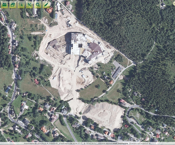
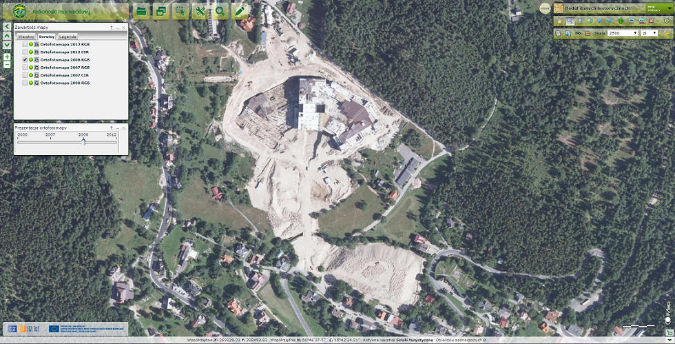
- Historical maps module - available only to authorized users, allows you to display a number of color orthophotos from different time periods (from 2000, 2007, 2008 and 2012) and infrared color orthophotos (CIR) from 2007 and 2012,
- Natura 2000 - containing the location and type of Natura 2000 areas designated in the Karkonosze National Park,
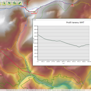
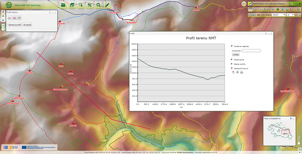
- Tourist route planning module - available to all users, enables planning of tourist routes based on the existing tourist infrastructure of the park and user-defined start and end points of the route,
- Tourism - containing information related to the tourist infrastructure in the Karkonosze National Park,
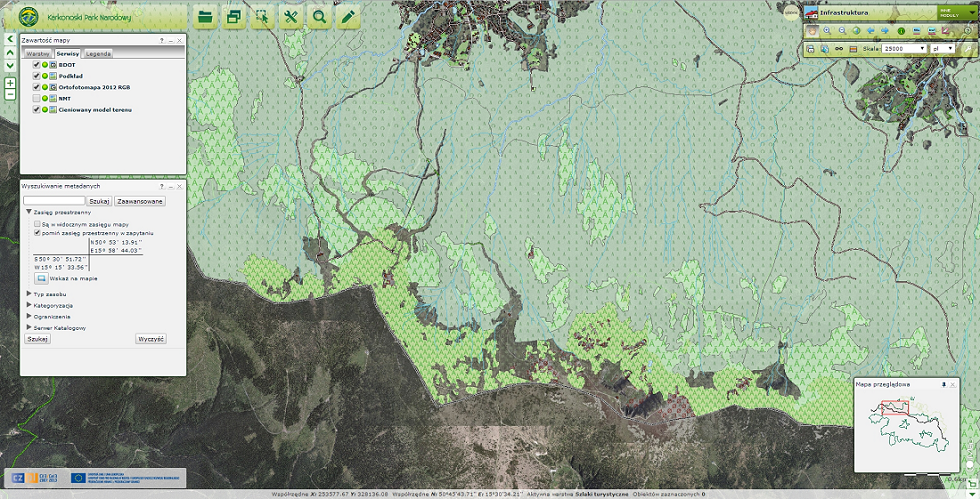
- Infrastructure - enabling the display of data from the BDOT database (Database of Topographic Objects) provided by the Central Center for Geodetic and Cartographic Documentation,
- Resources - a collective module presenting all layers and information contained in other thematic modules.
However, not all detailed data will be available to every user of the Geoportal, which results from the security policy of Poland. Each of them will receive an appropriate level of access.
The novelty in the application is the tourist route planning module. Thanks to the preparation of many appropriate tools, tourists have the opportunity to plan their trip, check how long it will take, and what difficulties await them on the route, and by reading the electronic map, they can also find out what the slopes they are to cross look like. Thanks to this implementation, everyone can first take a virtual walk along the path they have planned. Perhaps this will reduce the number of unnecessary accidents in the mountains.
The implementation was carried out under the European project "Karkonosze in INSPIRE - common GIS in nature protection", in cooperation with GISPartner Sp. z o.o. and GeoTechnologies Sp. z o.o. The project was dictated by the provisions of the INSPIRE Directive on spatial information.
