Scroll Top
OD WDROŻEŃ DLA MAŁYCH GMIN
PO ZŁOŻONE SYSTEMY CENTRALNE
KAŻDA SKALA
PLATFORMY
INFORMACJI
PRZESTRZENNEJ
ZARZĄDZANIE
PROCESAMI
ZAAWANSOWANE
INTEGRACJE
PORTALE
e-BOK
ANALITYKA
GRAFOWA
THE FIGURES SAY IT ALL
Our technology works in the largest IT systems in Poland, proving its reliability every day.
Each of the following numbers applies to a different, independent system.
0
citizen reports
0
monthly visits
0
documents in a system
a choice of our solutions
Spatial plans
All inclusive support in accordance with the law with fully automatic document generation
Infrastructure
Inventory and management of property and infrastructure, including extensive network infrastructure
Support portals
E-customer service for handling administrative decisions, including national authentication system
E-city & e-community
A comprehensive solution for the implementation of e-services and statutory tasks of local government units
Environment
From air pollution monitoring to water management, nationally and regionally
ERP/EAM integrations
Advanced, two-way GIS integrations with ERP / EAM systems, including SAP
Mobile apps
Advanced smartphone applications for Android and iOS with full support and updating
Range of integrations
Integration with document circulation systems, SMS and e-mail, e-payments, dedicated systems and other

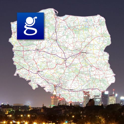
iMap - a proprietary GIS platform with powerful capabilities

Thanks to the use of our own solution, which is based on years of experience in GIS systems, we are able to offer a market-leading range of functionalities, flexibility, the highest efficiency and reliability.
Esri's Arcgis

Posiadamy status Bronze Partner światowego lidera rozwiązań GIS – firmy Esri, Inc. Nasze wdrożenia wykorzystujące platformę ArcGIS były wielokrotnie nagradzane.

Open source

Open software supported by our proprietary solutions and knowledge to enable particularly cost-effective implementations.

databases

Based on extensive competences and depending on the client's needs and implementation requirements, we optimally adjust the database solutions.

Broad technological competences

Thanks to experience, knowledge and the team, we adjust the technologies used in the implementation to the client's requirements, and not the other way around.

our implementations
During eighteen years of intensive work, we have built an impressive portfolio of implementations. Our solutions are used by local communities as well as public administration and business organizations from all over Poland.
Clear Filters
Geoportal Krajowy – najważniejsza mapa Polski
ISOK – Informatyczny System Osłony Kraju
GAZ SYSTEM – integracja systemów GIS i SAP
Krajowa Mapa Zagrożeń Bezpieczeństwa
Portal Geostatystyczny z danymi GUS
in every scale

GISPartner has been providing IT solutions since 2003. Excelling our software for years means that we are able to handle needs on virtually any scale.

01.
country

From strategic systems for central administration to international projects.

02.
region

Implementations for voivodships, poviats and various types of associations of territorial units.

03.
community

Projects for municipalities, in particular for cities with the size of several dozen to several hundred thousand inhabitants.

some of our clients
There are no clients that are not important to us. Here we present only a fraction of our systems, known more widely due to their territorial scope, thematic scope or level of complexity.
logo-geoportal
National Geoportal
Head Office of Geodesy and Cartography

The central point for spatial information in Poland, the purpose of which is to provide citizens, entrepreneurs and public administration with spatial information useful for business, sustainable development, environmental protection and management.

Logo GUS portal geostatystyczny
Geostatistics Portal
Statistics Poland

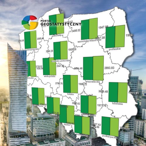
The Geostatistics Portal is a modern tool for presenting statistical data in spatial terms. It performs the functions of collecting, presenting and sharing information for a wide audience.

Logo ISOK
IT Country Protection System
National Water Management Authority

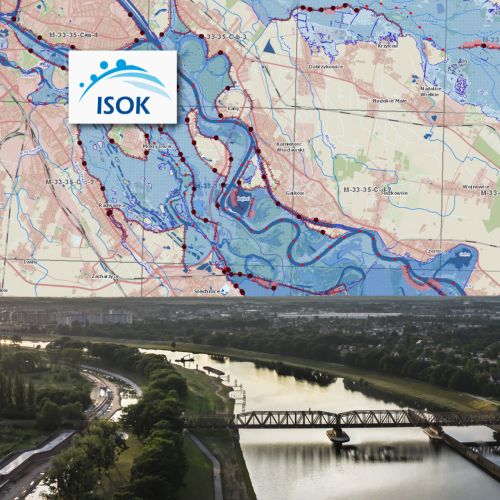
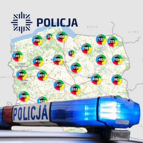
The system enables effective monitoring of the risk of the occurrence of meteorological and hydrological threats, the purpose of which is also to notify about the possibility of occurrence of threats. Its essence is to support the protection of Poland against the effects of possible threats.

Logo Wrocław
Geoportal of Wrocław
Wrocław City Hall

A geoportal created on the basis of our technology and developed for over 10 years, providing in one place a huge amount of geospatial information to Wrocław officials, business and residents, at the same time contributing to the development of the information society.

Logo GUS white
Logo Wody Polskie white
Logo Małopolska white
Logo Dolny Śląsk white
Logo GUGiK white
Logo Warszawa
Logo Wrocław white
Logo Gaz System white
news (in Polish)

Nowoczesny SIP w Wielkopolsce

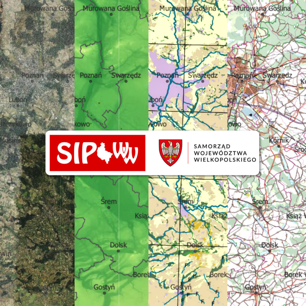
W Wielkopolsce startuje geoportal nowej generacji dostarczony przez konsorcjum z GISPartner w składzie

Odszedł Lech Nowogrodzki

Odszedł Lech Nowodworski

Tworzymy EDIH

Europejski Hub Innowacji Cyfrowych

Privacy policy
Kiedy odwiedzasz naszą stronę, może ona przechowywać niektóre informacje, zazwyczaj w formie "ciasteczek". W tym miejscu możesz zmienić swoje ustawienia prywatności, ale pamiętaj, że brak wyrażenia zgody może uniemożliwić korzystanie z naszego serwisu.